

More and more countries offers high-precision relief open data based on LIDAR measurements. I took the opportunity to integrate some in Opensnowmap.org map, including :
• France – RGE ALTI® 5m © IGN
• Switzerland – Alti3D © swisstopo
• US & Canada – NED 1arcsec U.S. Geological Survey
• Austria – DHM 10m – CC-BY-4.0: Land Kärnten – data.gv.at
• Italy – Tinitaly 10m – CC BY 4.0 Tarquini S., I. Isola, M. Favalli, A. Battistini, G. Dotta (2023). Istituto Nazionale di Geofisica e Vulcanologia (INGV).
• Norway – DTM 10 Terrengmodell (UTM33) – CC BY 4.0 Kartverket
Even if the final resolution is the same than previously (1 arcsec or approx. zoom level 12), the extra-precision add nice details to the map.
These dataset have been merged on top of the previous SRTM / ASTER / EU-DEM data with gdal, using a blend radius of 2 pixels (2 arcsec) on their edges.
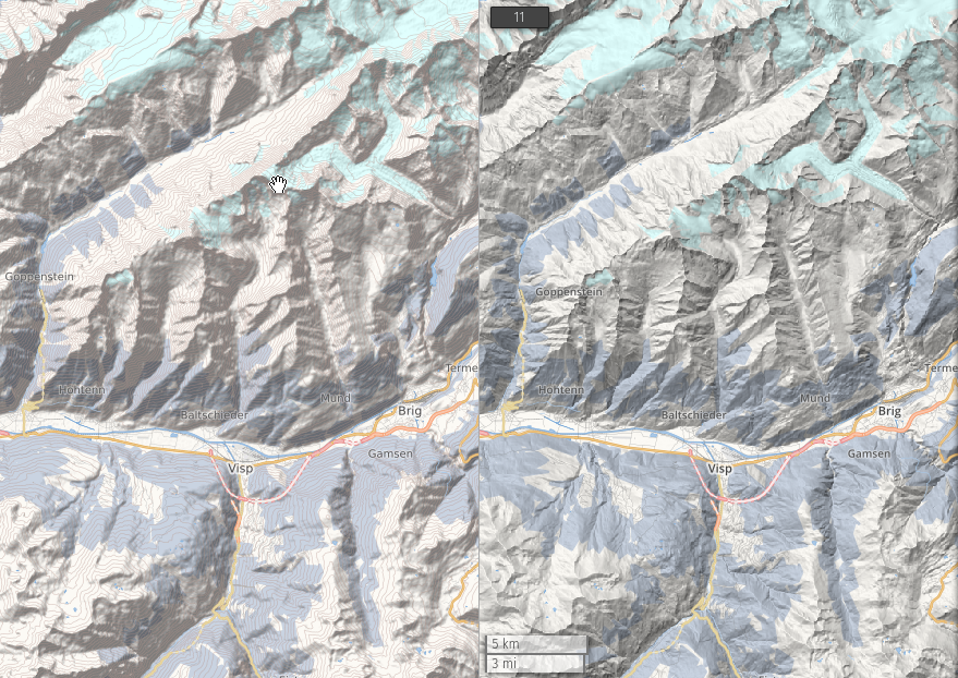
The hillshading has been re-computed using the excellent ‘Igor’ algorithm (from Igor Brejc, Maperitive author), this also add some interesting information on the north-west facing slopes.
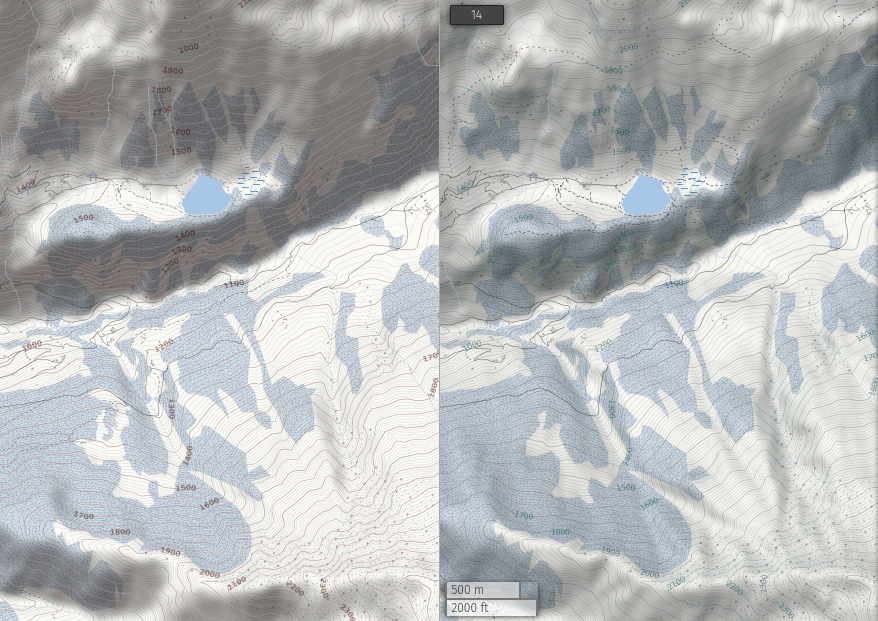
Nowadays it’s way easier than back in 2015 to play with those big datasets, mainly thanks to the availability of fast NVMe disks. This also mean that I could more comfortably refine some other elements of the map and their interaction with the relief. This concerns mainly the contour lines (also computed and optimized from the same upgraded relief data) and the small roads and their label.
Still, you’re not looking at a big contrast topo map, just the background map to display ski pistes at opensnowmap.org.
Hi! Could you elaborate a little bit on the merging method? tools, options, etc?
I plan to clean up the scripts and upload them to github, I’ll reach here when it’s done.
Quick answer however: I used gdalwarp -cutline -blend options to merge the smaller DEMs onto the previous world-wide one with no artefacts (at least none that I can see). The tricky part is to obtain good polygons for the ‘-cutline’, QGIS was of help here.
Ok, here are the backbone of my process: https://github.com/yvecai/DEM-scripts/tree/master/2023
Don’t hesitate to open a discussion on github if you have any question.