piste:difficulty on relations (EN – FR)

As you may have noticed, OpenSnowMap.org renders pistes with no difficulty tagged with faint lines, and, if you zoom enough, there is a ? icon on the pistes.

I figured out recently that some mappers add the piste:difficulty tag on route relations for crosscountry or nordic ski trails. So, I first thought, ‘great’, I missed that, let’s make nicer lines and get rid off all the question marks where I can.

But that’s not really helpful, as on about a third of those pistes, the piste:difficulty tag on relation is inconsistent as the one of the member ways. So, unless I’m missing something, I’d rather advise against lazy mapping and rather incite you to map the difficulty on ways.

What do you think ?

Comments are welcome on this diary entry or the tag wiki discussion page.

_________________

Vous l’aurez peut-être remarqué, sur OpenSnowMap.org les pistes qui n’ont pas le tag piste:difficulty mappé sont rendues avec une ligne plus légère. Si vous zoomez suffisamment, il y a même une icône ? sur la piste.

Récemment, je me suis rendu compte que certains mappeurs mettaient le tag piste:difficulty sur les relations ‘route’ pour le ski de fond. Super, je vais donc pouvoir mettre des lignes plus nette et enlever tout ces points d’interrogation là ou c’est possible.

Mais en fait non. Sur prés d’un tiers de ces pistes, la difficulté renseignée sur les membres n’est pas la même que celle de la relation. Alors à moins que je ne comprenne pas quelque chose, je vous encourage à laisser votre paresse de coté et utiliser le tag piste:difficulty sur les chemins, et non sur les relations.

Qu’en pensez-vous ?

Vous pouvez apporter votre commentaire sur cette entrée de mon  journal ou sur la page de discussion du tag.

OpenSnowMap donation drive winter 2020/2021 !

Opensnowmap.org is around for a few years now. The map tiles are viewed by tens of thousand of visitors each month.

Although not bleeding edge technology, I think it’s a good thing to have it around in the Openstreetmap ecosystem, along with others like Thunderforest outdoors, openskimap.org, waymarkedtrails.org and others.

The server has cost of around 1300Euros per year. The budget balance depends from donations for one part, the rest coming from my pocket.

Details on this page shows outstanding donation in 2016, 2017 (sharing work done on the map contours and hillshading were granted by generous gift from mapping companies) and 2019 (sharing the complete map with a heavy user behind a cache). Yet, throughout the years, only a very small amount is also collected from individuals.

I want to help !

For this 2020/2021 winter season, I decided to explicitly ask here for recurring donations in order to sustain the website without relying on an occasional windfall, and also to give you the occasion to show your support.

You can do this with paypal via the donation page or contact me via email found there to do a wire transfer.

You won’t avoid Paypal or your bank fees, nor have a tax refund: we are talking about ski here, OpenSnowMap certainly don’t claims to be an NGO or charity organization of some kind.

What you get ?

Now what do you get that is not already available? First, all my love, the satisfaction to show your support to a map you like, and assist its goal to propose a nice rendering of ski pistes in order to attract new contributors completing the map. But with a new year starting, here are a few resolutions I consider:

  • Discuss with the OSMF the trademark licence for “opensnowmap” name and domain (long overdue)
  • Add a few README and CONTRIBUTING to the github repositories to help people willing to help.
  • If the recurring donation allows it, add a fallback mirror 4TB SSD for the database.
  • And of course voluntarily maintain the service for the years to come.

A word on resources sharing

OpenSnowMap server is rented at Hetzner for 113.88 euros per month.

It serves the map can be seen at www.opensnowmap.org, of course, but also on a few other websites.
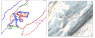
The piste-only tile overlay is open to all websites and Apps. On the contrary the topo ‘base snow map’ use is restricted to ensure a good quality of service. Its use is granted to a few websites dedicated to winter sports and run by enthusiasts. The only heavy user is www.snow-forecast.com, they manage a good exposition to our map while heavily caching the tiles themselves, and supported the server upgrade in 2019.

Discussion is always open to grant access if your project can helps ski mapping in OpenStreetMap awareness from potential contributors and/or technical or financial help to support load beyond 50’000 tiles per day.

Sincerely yours, Yves
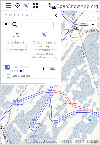
New server is being deployed – URL change

Dear users, A generous donation accelerated the deployment of OpenSnowMap.org on a more powerful server. No big changes, except a faster rendering and the possibility to serve more tiles. This will help in following the increasing number of requests for ski maps.

Many thanks to the team at snow-forecast.com !

Part of the map requests are already handled by this new server, so you may experience a longer load time while the tile cache is building up.

If you are using the ski map tiles on your own website, please use the url http://tiles.opensnowmap.org/pistes/z/x/y.png, tile servingfrom http://www.opensnowmap.org/pistes/z/x/y.png will soon be deprecated. Also, heavy users (> 50’000 tiles per day) are requested to access the tiles via their own cache.

Keep an eye on map changes

Some of you may already use the daily and weekly change view of Opensnowmap.org to check for changes on the ski pistes they mapped.
Today, this view have been improved and now gives more information about the actual change. Is this a way, a relation deleted, a simple node moved? A new processing associated with a detailed legend will help to better understand thechanges and maybe spot errors.

See, yesterday apparently someone seems to have refined a nicely mapped skating ring.

This view coupled with the  button will allow you to find more information about the modified element. It is still a bit frustrating not to be able to check on deleted elements, I will try to add daily and weekly .html change list to allow this.

In practice, each night, the pistes of the OpenStreetMap database at 00:00GMT are compared to the pistes that were there the day and the week before. Geometries are simplified in order not to display to much information.

Pistes de fond dans le jura: ce qui reste à mapper

L’Espace NordiqueJurassien partage le tracé des pistes de ski de fond depuis l’espace pro de sa carte interactive (carte dispo ici ).

Ces tracés sont d’origines diverses, et il ne fait pas sens de les copier dans OpenStreetMap. Cependant,cela permet une comparaison, et on peut voir ainsi que près de la moitié des pistes de ski de fond du Jura français ne sont pas mappés dans OSM ! Sans surprise, les coins les plus courus et les plus enneigés sont mieux cartographiés que les autres.

J’en ai fait une carte qui permet de savoir ou poser vos skis cet hiver pour compléter, c’est ici: OpenStreetMap.org et EspaceNordique Jurassien: Pistes de ski nordiques manquantes dans le Jura

Parmi les sites les plus mal servis, on trouve:

  • Belleydoux
  • Bolandoz
  • Chaux des Prés
  • Frasne
  • Le Haut Saugeais Blanc – Hauterive La Fresse
  • La Malmaison
  • La Combe Saint Pierre
  • Le Lac des Rouges Truites
  • Les Combes Dernier
  • Les Crozets
  • Les Granges Dessus
  • Longchaumois
  • Le Meix Mussy
  • Menthières
  • Nods
  • Saint Laurent en Grandvaux
  • Val de Vennes

Je vous souhaite bien du plaisir à découvrir ces sites lorsque la neige seraen quantité suffisante !

New piste preset for iD

I made some modification in the ski piste presets for the iD editor. This is mainly intended to differentiate the meaning of piste:grooming and piste:difficulty tags depending on the type of piste(downhill, nordic, hike, etc …).

Descriptions are according to the wiki, which is rather stable for years.

Maybe some want to give it a try here to see if everything looks fine: iD master preview.