• France – RGE ALTI® 5m © IGN
• Switzerland – Alti3D © swisstopo
• US & Canada – NED 1arcsec U.S. Geological Survey
• Austria – DHM 10m – CC-BY-4.0: Land Kärnten – data.gv.at
• Italy – Tinitaly 10m – CC BY 4.0 Tarquini S., I. Isola, M. Favalli, A. Battistini, G. Dotta (2023). Istituto Nazionale di Geofisica e Vulcanologia (INGV).
• Norway – DTM 10 Terrengmodell (UTM33) – CC BY 4.0 Kartverket
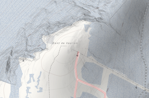
Even if the final resolution is the same than previously (1 arcsec or approx. zoom level 12), the extra-precision add nice details to the map.
These dataset have been merged on top of the previous SRTM / ASTER / EU-DEM data with gdal, using a blend radius of 2 pixels (2 arcsec) on their edges.
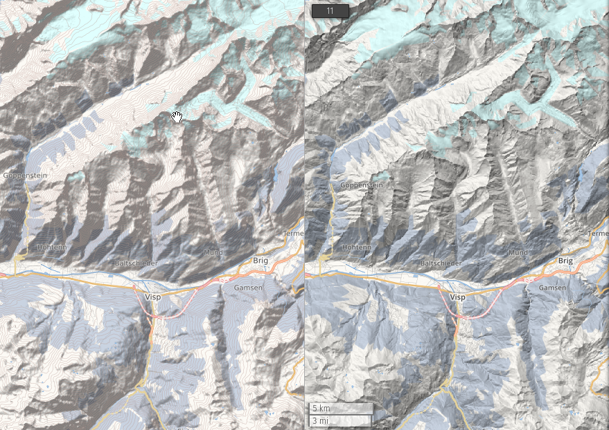
The hillshading has been re-computed using the excellent ‘Igor’ algorithm (from Igor Brejc, Maperitive author), this also add some interesting information on the north-west facing slopes.
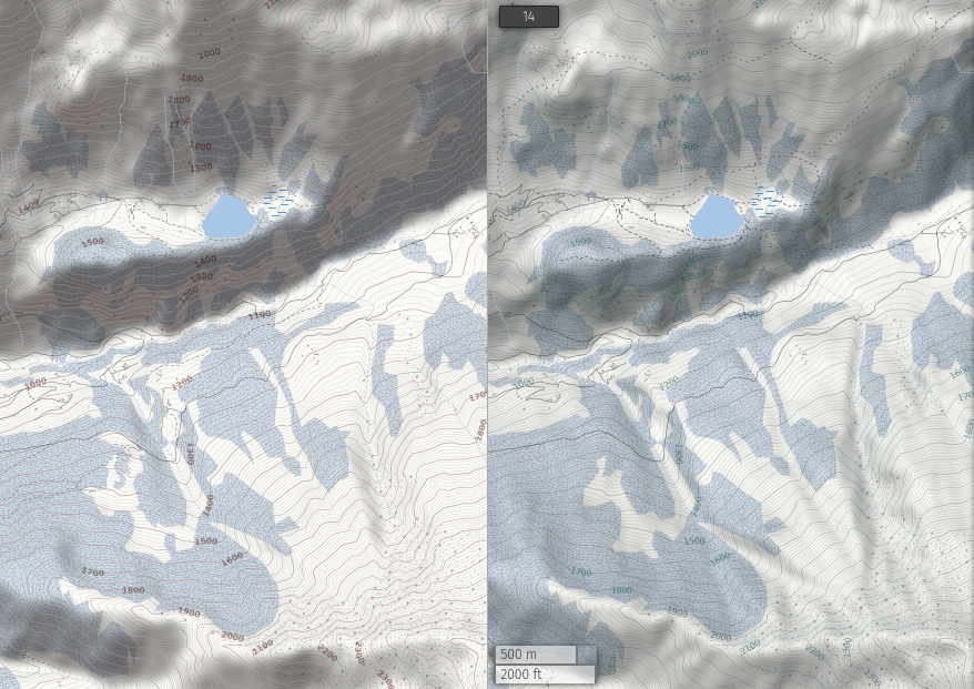
Nowadays it’s way easier than back in 2015 to play with those big datasets, mainly thanks to the availability of fast NVMe disks. This also mean that I could more comfortably refine some other elements of the map and their interaction with the relief. This concerns mainly the contour lines (also computed and optimized from the same upgraded relief data) and the small roads and their label.
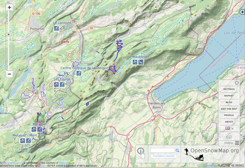
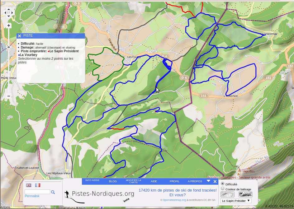
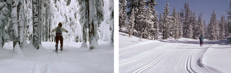
Still, you’re not looking at a big contrast topo map, just the background map to display ski pistes at opensnowmap.org.
]]>In the next weeks, the map refresh may be suspended and zoom level beyond Z16 unavailable.
]]>After:
The data is from SwissALTI3D. They are processed on-the-fly in your browser, so display can be quite slow and ressource-intensive.
]]>In some regions, the piste preparation is much lighter and the majority of pistes are just signposted crosscountry ski routes for crosscountry touring with extra-large skis.
On OpenStreetMap, we use the tag piste:grooming to describe accurately the various practices.
Yet today (25.06.2022), there is no way to know what kind of gear is well-suited to run 24 % of the nordic skiing pistes already mapped, that is 22’303 km.
On Opensnowmap.org, these pistes appears with a dashed pattern from zoom 12, and display a perplexed skier from zoom 15 onward.
You can also find pistes where the piste:grooming tag is no set on a way nor a relation from this overpass query : https://overpass-turbo.eu/s/1jEl
[out:json][timeout:90]; way["piste:type"="nordic"][!"piste:grooming"]({{bbox}}) -> .nogroomingway; rel(bw.nogroomingway)["piste:type"="nordic"]["piste:grooming"] -> .groomingrel; way(r.groomingrel) -> .groomingway; (.nogroomingway; - .groomingway;); out geom;
Here is a reminder of the wiki’s definition:
piste:grooming=classic Two rails for classic style nordic.
piste:grooming=classic;skating Wide piste for skating and at least one set of classic rails.
piste:grooming=skating Wide piste for skating (or ‘free’) style nordic.
piste:grooming=scooter Classic style groomed by a smaller snowmobile, which means that the piste is often much looser and single lane.
piste:grooming=backcountry Un-prepared itinerary for cross-country skiing, tracks are made manually by skiers.
]]>Once based on Osmosis, it is now built on top of a DB created by Osm2pgsql, thanks to the nice work done with its flex-output (and doc!) in the past years. Even the routing function is now directly integrated in the same database.
Normally, you won’t notice big differences when using OpenSnowMap.org, except a huge performance improvement in the requests response delay: in the process all database queries have been optimized and the code simplified.
]]>Fatbike and lift icons are already rendered on the map, but yet to be updated on the pistes lists in the website.
]]>All known piste:type ways and relations are routable (that is, if you don’t know them yet: nordic, downhill, connection, sled, hike, skitour, ski_jump, ski_jump_landing_area, fatbike, sleigh, playground, snow_park, and of course every semi-colon separated combination of those).
The long overdue feature is that this new router take into account way directions: you may find it harder to go uphill for alpine pistes, and downhill with lifts.
For all pistes, the tag piste:oneway=yes/no/-1 is honoured (or oneway=* if no highway=* tag is present on the same way). Lifts are considered oneway only, except aerialway=gondola and aerialway=cable_car, or if oneway=no if specified
Last, some pistes are logically excluded when an access tag is present that contradicts the piste:type=* tag, like ski=no, foot=no and bicycle=no or discouraged. A know limitation is that doesn’t affect relation members yet.
So, if your favorite resort is not routable yet, it’s time to check the connection between the pistes, and lifts. Do you know about the tag piste:type=connection ?
The routing functionality is still a ‘draw yourself a route’ between waypoints feature. If you’d like a different flavor of ski routing, you may want to try the one at freemap.sk.
Thanks a lot for Michal (freemap.sk) work on ski routing with OSRM, even though in the end, Opensnowmap is now using PGrouting.
]]>I hope you won’t be too disappointed to see the old design disappear. This was inherited from ‘pistes-nordiques.org’ that started back in 2011 (if the commit history is right !).
I can’t resist to rebuild the first look of the website back in 2013, of course OpenMapquest tiles are missing.
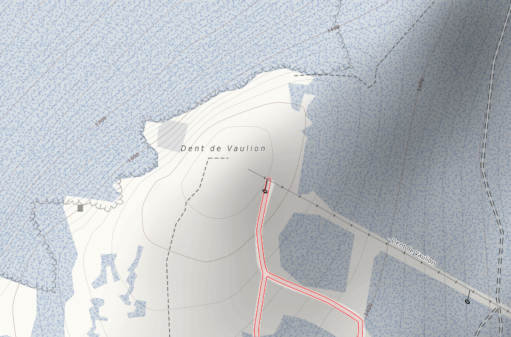
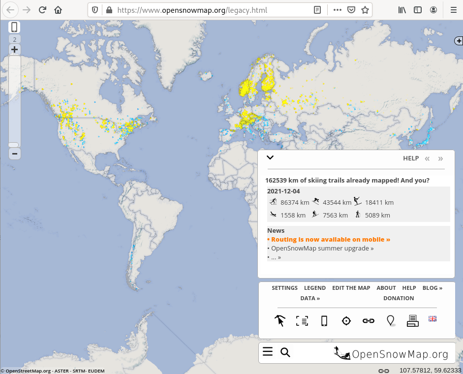
Legacy OpenSnowMap.org version for desktop as of end 2022.
First look of OpenSnowMap.org somewhere in 2013.
While we’re at it, do you remember this one below ?
pistes-nordiques.org march 2012
In case you feel lost, you can still find the old version (at least for a while) from the menu ‘LEGACY OPENSOWMAP’.
]]>Routing works in a similar way than on the desktop version, it’s only point and click (or rather tap and tap), there is no geocoder. You can however use the ‘Search’ menu to find your pistes.
Just tap near a piste, a waypoint will be snapped onto it. Then drag the point if you want to relocate it accurately. You can add as many waypoint you want, and insert a point along a way to move it afterward.
When you want to exit the routing mode, just tap on the blinking blue routing icon.
No change as been made (yet) on the server-side router, you can still climb back alpine descents and take lifts the other way around. Let say it’s a feature !
]]>